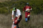
Morgan Territory Regional Preserve
Date: (Sun.) Oct. 30, 2011
Location: Livermore, CA
Event Director: - 925.516.7622
Course Setter: François Léonard
Type: B; This is sure to be a great day at a park that never fails to satisfy. Beautiful rolling hills with gorgeous Fall weather in the oaks!
Course Setter’s Notes
By François Léonard
Welcome to Morgan Territory! This year we are offering 7 courses, from White to Blue. All the courses use the same Start, which is 250 meters from the Assembly area. The Finish is next to the Assembly area for all the courses.
White Course
This course is designed for beginners or children. All the controls are on trails, with a control located at every decision point (e.g., when having to decide which trail to take at an intersection).
Yellow Course
This course is for more experienced beginners and older children. Controls can be found by following trails, except that the control itself may be somewhat off the trail, forcing you to read the map in a bit more detail. There may be decision points on the course (e.g., which trail to take at an intersection) where there won’t be controls.
Orange Course
The Orange course, at 4.1 km, is longer that the White or Yellow courses. Navigation is at an intermediate level, with controls sometimes located significantly off-trail. Often, the legs are designed so that a runner has to make a choice between an easier but longer route, or a more technical but faster option. The main purpose of the Orange course is to help participants transition to the more advanced courses.
Brown, Green, Red, and Blue Courses
The advanced courses this year will be more technical, with less route choice, than usual. One could describe them as having pockets of technicality with many controls separated by longer legs. Climb is relatively low by Bay Area standards, in the 3–4% range. There is one fence crossing on the Blue course — the fence is new, and the best technique is probably to crawl under it on the ground, or take a 200 m detour (one way) to use a gate.
Terrain and Map
Morgan Territory has some of the nicest terrain in the Bay Area. The terrain is approximately 50% open oak forest, 40% grassland, and 10% fight. The "white" forest has good visibility and running, except on the steep slopes. There is a moderate trail network. There are numerous rock features and some fine contour detail, which will provide interesting and challenging orienteering. Poison oak is not prevalent in the area that we will be using. At this time of year it has lost most of its leaves, and is found mostly around rock features, and in the form of sparse ground patches of 1-foot-high branches.
The most important aspect of the map for this event is that it requires interpretation. This means several things:
- There are many rock features in the terrain. The mapping of these is ... interesting. Sometimes the smaller boulders are not mapped, and sometimes they are mapped as small back dots. Sometimes, a 1 m high boulder is mapped by itself on the map, but is surrounded by smaller boulders that make it hard to identify. The black triangle symbol is used to indicate a boulder cluster, but in areas where several of these are close together it can be hard to differentiate them.
- Clearings are mapped extensively, but the small ones can be hard to identify sometimes.
- Fallen trees are mapped as green ×'s. But some fallen trees are not mapped. I have corrected this in some areas, but not extensively.
- On this type of terrain, "white" forest can consist of very sparse trees; in addition, a cluster of even just two trees can be mapped as a white patch. That said, more distinct trees are mapped with open green circles.

