
Collage of park scenes by Manfred Kopisch
Click for larger image (http://baoc.org/gallery/albums/CoyoteLake/2018_Coyote_Lake_Photos.jpg)
Coyote Lake-Harvey Bear Ranch County Park
Date: (Sun.) Feb. 9, 2020
Location: Gilroy, CA
Event Director: ![]() - 510.525.1574
- 510.525.1574
Course Setters: Daniel Å ebo, Lubomir Sebo
Type: B; Standard 7-course event for beginners through advanced
Related Event Information
Event Announcement Attackpoint Event Page (http://www.attackpoint.org/eventdetail.jsp/event_47316)
Course Setters’ Notes
by Daniel and Lubo Å ebo
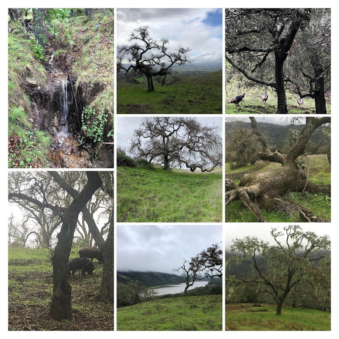
The winter storms have faded away, and now new blades of green, rejuvenated by the rainfall, cover the rolling hills. This is Harvey Bear Ranch at its best, featuring open oak forests brimming with joyful life that ranges from wild pigs to scurrying turkeys. Come on out to enjoy the full array of seven Classic courses that will explore some of the most scenic and delightful parts of this jewel of a park.
The ground is comfortably soft but not muddy. The stickers that often plague orienteers are gone. Poison oak is still mostly dormant, and the weather conditions are expected to be perfect for running. This is the best time for orienteering in this park!
Course Details
                                            Water
   Course   Length      Climb     Controls  Stops  Navigation     Map Scale   Map Size
   White    3.5 km    70 m  2.0%      9       0    Beginner       1:7,500     Letter
   Yellow   3.5 km   110 m  3.1%      9       0    Adv. Beginner  1:7,500     Letter
   Orange   4.5 km   150 m  3.3%     13       2    Intermediate   1:7,500     Legal
   Brown    4.1 km    80 m  2.0%     15       3    Advanced       1:7,500(*)  Legal
   Green    5.6 km   180 m  3.2%     12       3    Advanced       1:10,000    Legal
   Red      6.5 km   250 m  3.8%     15       4    Advanced       1:10,000    Legal
   Blue     8.1 km   310 m  3.8%     17       4    Advanced       1:12,500    Legal
- (*) A limited quantity of Brown maps printed at 1:10,000 scale will be available at the Start upon request.
Comments about the courses are below.
Note that there are two Start locations:
- The Start for the White and Yellow courses is 0.5 km (with 50 m climb) from the assembly area. Follow the streamers.
- The Start for all the other courses (Orange through Blue) is 1.5 km (with 90 m climb) from the assembly area. Follow the streamers through the White/Yellow Start, and continue further on the same trail with streamers. Plan on taking at least 20 minutes to get to the Start.
Map and Terrain
The map is in good shape, being updated selectively over the past few years. The only times when it may seem vague is when it comes to distinctions between individual trees and forest. Sometimes what appears to be an individual tree close to a forest may be mapped as part of the forest.
The brown × denotes a fallen tree of varying shapes and forms. Take note that new trees may have fallen, and not make it onto the map. The green × feature denotes a dead tree that is still standing, not to be confused with its brown counterpart.
Green dots mean either small lone trees or bushes.
Animal trails may not be mapped, but for the most part, these are quite small.
Hazards and Wildlife
There are a few things orienteers should be aware of when traveling at high speeds. The park features scattered “potato†rocks, dubbed so because of their relatively small size. Appearing innocent from above, these rocks can easily cause a nasty fall or a twisted ankle if one is going off-trail and not paying attention.
In addition, like almost every Bay Area park, Harvey Bear does contain some poison oak. Most of it is small and low, with its shoots reaching up to knee or hip level, while several larger thickets of it are present across the park. The leaves are just about to appear, meaning that sometimes it is not as visible as usual. However, be aware that even the bare stalks should be avoided.
The park also has some more pleasant surprises in the form of animals. Wild pigs roam along the hillsides, but unless very aggressively threatened, they usually run away when they see humans. Spotting these is one of the special treats this park has to offer. Similarly, deer and cows also inhabit the hills in normal numbers. The animals are not aggressive. However, try to not startle the cows—run around groups of cows rather than through them. Do not get between a calf and its mother! Don’t startle horses—give them right of way (ask the rider if it’s okay to run around).
Course Comments
White Course (Easy Beginner)
The White course follows trails. You will need to recognize them on your map and in the terrain, and make the correct turns at the trail junctions. There is no poison oak on the White course.
Yellow Course (Advanced Beginner)
The Yellow course has some off-trail segments. You will mostly follow linear features (trails), and will need to leave the trail near the controls. There is some overlap with the White course.
Orange Course (Intermediate)
The Orange course is off-trail and focuses on contour reading. Locating the correct spur, hilltop, saddle, or depression with your control will present an interesting challenge for participants. Save your energy, since there is a lot of climb at the end of the course. There is no need to cross barbed-wire fences. Some controls from different courses are close to each other, so don’t forget to check the numbers.
Brown, Green, Red, and Blue Courses (Advanced)
The advanced courses are designed for orienteers who are able to make full use of their maps, compasses, and the terrain. The Brown course does not have too much climb, and the other courses are similarly very fast but have at least one steep segment.
The only two courses where you may have to cross a barbed-wire fence are Red and Blue. Don’t jump or climb over the fences. Roll under the wire—it is quick and safe.
The deep, eroded re-entrants on the north part of the map (only on the Blue course) are steeper than they appear on the map. The Blue map is printed at 1:12,500 scale, which allows everything to fit on legal-size paper and still be detailed.
There are plenty of water controls on the advanced courses.