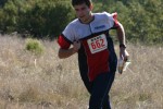
BAOC COOL Orientation and Courses
Oyster Bay Regional Shoreline
Date: (Sat.) Oct. 30, 2010
Location: San Leandro, CA
Event Director: - 925.872.3935
Course Setter: Jay Hann
Type: Junior; Short Orientation To Our Interscholastic League
At this event, there will be an introduction for those students who may be interested in the Bay Area Orienteering Club California Outdoor Orienteering League (BAOC COOL), but don't feel they're ready. Or for anyone who just wants to have fun! This event is free.
Already in the league? Come by to help teach the new students, to see your friends again, and to have fun!
You don't have to be involved with the league to try these courses. Everyone is welcome to try.
Event Schedule
- 9:00 – COOL map orientation begins, meet at the Neptune Drive entrance
- 9:45 – COOL: How the league works
- 10:15 – COOL: Fun and Games with a Mini-O
- 11:00 – End of COOL activities
Course Statistics
There will be no water on the courses.
Here are the preliminary course statistics for Saturday:
                                          Percent  Navigation
   Course       Length   Climb  Controls   climb   difficulty
   Course 1     0.7 km    23 m     11      3.3%    Beginner
   Course 2     0.8 km    18 m      6      2.2%    Adv. Beginner
   Course 3     1.2 km    15 m      7      1.2%    Intermediate
   Course 4     1.3 km    25 m      9      1.9%    Advanced
Maps
Some of the scrubby areas have been re-mapped with way too many individual bushes and dog trails. Only the major dog trails visible from the air in September were mapped. There are many more minor trails. The current lush carpet of grass has partially obscured some of the trails. All maps are printed at a 1:4000 scale with 2.5-meter contours.
Punching
There will be electronic punching used on all the Mini-O courses. Electronic punches (finger sticks) will be available for those who don't have a finger stick. You will be able to repeat another course or the same course using the same finger stick. We will be using the GeBE printer to download and print results.
Driving Directions
From north or south I-880 (Nimitz), exit 33B Marina Blvd. Go right (West) on Marina Blvd about 1.3 miles, to a short right-turn lane at Neptune Dr, just before the main road bends left. Turn right (North) onto Neptune Dr, and go 0.6 miles to the end. Park on the street.
There's a map here that shows the location of the event.
Public Transit
Public transportation is poor in this area. Your best bet is to BART to San Leandro station, then walk 2.7 miles or hire a taxi cab. Better yet, maybe people can carpool.
Google walking directions from San Leandro Bart Station:
- Head southeast on San Leandro Blvd toward Parrott St – About 5 mins, go 0.2 mi
- Turn right at Williams St – About 39 mins, go 2.0 mi
- Turn right at Neptune Dr – About 9 mins, go 0.5 mi – Total 2.7 mi

