Shell Ridge Open Space
Date: (Sun.) Feb. 14, 2010
Location: Walnut Creek, CA
Event Director: - 510.407.1876
Course Setters: Gavin Wyatt-Mair, William Morris, Jay Hann
Type: B; "Open" event in conjuction with a BAOC COOL (Junior) event
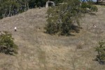
Shell Ridge is a beautiful open space in Walnut Creek, with rolling grasslands, patches of oak forest, assorted rock and stream features, and plenty of contours. Visibility is good to excellent. The grass is green and getting long, so watch your footing. Bring good shoes with spikes or cleats, because it is slippery on the steeper slopes if they are wet. Weather conditions could vary from sunshine to rain, and 45 to 60 degrees — so do check the forecast and come prepared!
There is no poison oak and negligible stickers — you can easily run these courses in shorts if you like. Wildlife is relatively dormant in winter, although there will be turkey buzzards and a few ground squirrels.
The map is generally poor in vegetation quality — some trees may not be mapped, while others of equivalent significance are. It's a good idea to cross-check with other features and not rely heavily on vegetation for navigation. There are many rock features, but again the mapping is somewhat inconsistent. The rock features that are mapped are located reasonably well.
The Start is a 10-minute walk from the parking and registration area. First starts will be at 10:00 and last starts at 12:30. Courses close at 2:00. Please be sure to check in at the Finish and then the download tent by then, even if you haven't completed your course.
Parking is on the street near the park entrance, and is somewhat limited, so please park close together — and carpool if you can.
Courses
The usual White, Yellow, Orange, Brown, Green, Red, and Blue courses will be offered. All the courses will have E-punch. Advanced courses will visit the more complex north side of the ridge.
Here are the details of the courses.
                                         Navigational   Physical
   Course    Length    Climb   Controls  difficulty     difficulty
   White     2.8 km     85 m      12     Easy           Easy
   Yellow    3.1 km     85 m      12     Easy           Easy
   Orange    4.7 km    180 m      12     Moderate       Moderate
   Brown     4.3 km    190 m      12     Hard           Moderate
   Green     5.4 km    230 m      15     Hard           Hardish
   Red       6.3 km    295 m      18     Hard           Hard
   Blue      7.1 km    350 m      20     Hard           Hard
See the Course Setter's Notes for more information.
Request for Helpers
We would really like to have your help at this event. Please let know if you have a favorite activity (Starts, Finishes, Beginners' Clinics, Control Pick-up, etc.) and a favorite time to help. Not sure how to do it? We'll show you how!
Driving Directions
Traveling north on I-680, take the Ygnacio Valley Road exit (which is just north of the Hwy 24 interchange). Turn right onto Ygnacio Valley, and go 0.9 mi to Homestead Ave. See below for the continuation from there.
Traveling south on I-680, take the N. Main Street exit, and head south on Main St. Turn left onto Ygnacio Valley and go to Homestead Ave.
Turn right onto Homestead, and go 0.2 mi to Marshall Drive (the first street on the left). Turn left onto Marshall, and go 1.1 mi to Indian Valley Elementary School (at the end of Marshall). The school gates are closed on weekends, so park on the street.
There's a map here that shows the location of the event. (Click on the "pins" in the East Bay until you find the one for this event, and then drag the map [not the pin] to center the pin, and zoom in to see more detail.)

