Camp Tamarancho
Date: (Sun.) Aug. 17, 2008
Location: Fairfax, CA
Event Director: - 510.407.1876
Course Setter: Greg Ehrensing
Type: B; Standard seven courses--White (easy beginner) through Blue (strenuous advanced)
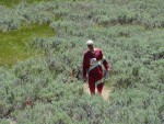
Yes, we're back again, and hopefully better than ever. Enjoy the vistas of Mt. Tamalpais, Mt. Diablo, San Francisco Bay, Loma Alta, and sweeping views of Marin. The terrain is mixed with oak forest, and open, steep grassland, fir forest, redwoods, and ferns. The trail network is moderate and a little unkempt. Maps are 1:10000 with 5-meter contours.
We will offer seven pre-marked courses: White, Yellow, Orange, Brown, Green, Red, and Blue. E-punch will be used for all courses. Registration opens at 9:00 AM. Starts will be from 10:00 AM until 12:30 PM. Registration and other event activities will be located on Staff Hill, a lovely shady area with lots of picnic tables and convenient bathrooms, a short walk (less than 400m) from the parking areas.
Greg Ehrensing is working on some great courses, and we'll be posting more details here and on Bay-O-Net.
Just a few important rules so we can continue to use this map:
- No Dogs (not even in cars)
- No Alcohol
- Park facing outward (back into your space)
- Carpool if possible—see below
Please volunteer! We will need folks for traffic direction as well as the usual starts, finishes, beginners clinics, control pick up, and registration. Contact the if you can help.
Here are the course statistics:
Course Length Climb Controls
  White     1.4 km     50 m      11
  Yellow    2.5 km     95 m       8
  Orange    4.1 km    225 m      13
  Brown     3.5 km    195 m      11
  Green     3.9 km    300 m      15
  Red       5.0 km    350 m      17
  Blue      6.2 km    430 m      21
More information is available in the Course Setter's Notes.
Driving Directions
From Highway 101 in Marin, take Sir Francis Drake Blvd until you reach downtown Fairfax. Continue westbound on Sir Francis Drake past downtown for another quarter mile and look for the green highway sign that says "Camp Tamarancho". Turn left at this sign onto Olema Road, and continue to follow the orienteering signs until you reach Iron Springs Road. Head up Iron Springs Road for two miles until it ends at the camp entrance.
Warning: Iron Springs Rd is a narrow, winding, partially-paved road with lots of small to moderately sized potholes. A car with normal clearance can make it if driven carefully. Low-riders and sports cars are not advised. Please allow at least 15 minutes for these last two miles.
Carpool Site
TBD

