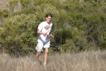
Briones Regional Park
Date: (Sat.) May. 14, 2005
Location: Lafayette, CA
Event Director: - 510.658.4327
Course Setter: Penny DeMoss
Type: C; Advanced courses only; No beginner or intermediate courses
Related Information
Course Setter's & Event Director's Notes Additional ED/CS Notes Last Year's Event (http://www.baoc.org/results/r04/r040418.php)
The Briones Orienteering Event will be held on Saturday May 14th. Due to parking restrictions at the Alhambra entrance to Briones Regional Park (the north end of the map), there will be no beginner or intermediate courses. White, Yellow, and Orange courses will NOT be offered. The courses will be for advanced orienteers only.
The courses offered are as follows:
  Brown    3.4 km     220 m climb     9 controls
  Green    4.8 km     325 m climb    12 controls
  Red      6.0 km     445 m climb    12 controls
  Blue     7.25 km    545 m climb    15 controls
Registration will be from 9:00 AM until noon. Starts will be available from 10:00 AM to 12:30 PM. Courses close at 2:00 PM.
We will be using e-punch (http://baoc.org/faq/e_punch.php) on all courses. The start is 500 m from parking and registration. The finish is about 800 m from registration and E-punch download. The map scale is 1:10000 with a contour interval of 7.5 m. The area is a combination of high hills, open grassy meadows and valleys, creeks, ponds, and valley oak/bay forests. There is poison oak, too, so bring your Tecnu and take the usual precautions.
Driving Directions
Take the Pleasant Hill Rd. exit off of Highway 24 in Lafayette. Go north on Pleasant Hill Rd. for 0.8 mile, and turn left onto Reliez Valley Rd. Stay on Reliez Valley Rd. for 4.6 miles. Turn left at the large, brown sign that says Alhambra Creek Valley Staging Area of Briones Regional Park. It is 0.8 mile to the parking kiosk. After parking, follow signs 100 m to registration in the orchard.
Did I mention that there will not be beginner or intermediate courses?


