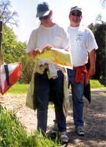
Calero Reservoir
Date: Sunday, October 3, 2004
Location: Morgan Hill, CA.
Event Directors and Course Setters:
- 408.732.4818
- 408.996.8749
Type: B; White (Beginner) through Green courses, with compressed chase format for a long course than includes both the Brown and Green courses. Something for everyone!
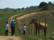
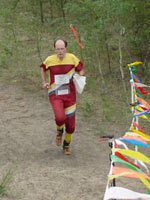
Welcome to the Bay Area Orienteering Club's annual event at beautiful Calero Park. At this year's event, in addition to the regular beginner and intermediate courses, we will be using the "compressed chase" format for some of the advanced courses.
In addition to the regular beginner (White, Yellow) and intermediate (Orange) courses, a Short Orange will be offered. The Brown and Green courses will be shorter than usual, since they will also be used as the preliminary and final courses of the compressed chase. So, if you are a regular Brown runner, you might consider moving up to Green. If you are a regular Green runner, we hope that you consider taking part in the chase as the courses have been shortened to make the chase feasible also for Green runners as well as for Red and Blue runners.
Course     Distance  Climb  Navigation     Terrain

White      3.4 km    195 m  Beginner       Trails
Yellow     3.1 km    210 m  Adv. Beginner  Mostly Trails
Shrt Orng  2.4 km    210 m  Intermediate   Off-trail, Moderate
Orange     3.2 km    240 m  Intermediate   Off-trail, Hard
Brown      2.1 km    195 m  Advanced       Off-trail, Moderate
Green      3.3 km    285 m  Advanced       Off-trail, Hard
The registration and beginner's clinics will be in the parking area near the main office. There will be a remote start/finish area for all the courses. To reach the start, proceed through the gate across the driveway from the registration area and follow the streamers along the trail for approximately 1.5 km. Allow 25 minutes to reach the start. All participants are encouraged to bring a picnic lunch with them to the start/finish area and stay and enjoy the chase, which will contain spectator legs.
Both Orange courses and all the advanced course use electronic punching, so don't forget your e-sticks. You can rent an e-stick at the registration, if you don't own one.
Regular course participants should expect the usual schedule for local events, i.e., starts from 10:00am - 12:30pm, with the exception that we will need to close the regular Green course starts earlier than usual at 11:45am to prepare for the chase. We'll reopen them briefly after the chase starts to accommodate any late arrivals.
If you are planning to run in the compressed chase, arrive early enough to allow time to get to the remote start/finish area, run the Brown course, and allow any rest time you'd like before the start of the final of the compressed chase, which we will be starting as close to 12:00 noon as possible. Even the strongest runners should plan to start the Brown course no later than 11:15, and note that you may have to wait for a start time as almost all the advanced runners will be running the Brown course.
New map
A large part the Calero map has just been remapped by Zoron Krivokapic. All the courses will venture into the newly mapped parts of the map. The maps are printed at a 1:10,000 scale with 25-foot (~7.5 m) contour intervals. Clue sheets are printed on the front of the maps.
On the newly mapped areas the mapper is using a non-standard "green T" symbol to mark fallen trees. The symbol is oriented to point the direction of the fallen tree trunk. Note that the "green T" symbol is fixed size, thus it only indicates the direction of the trunk, not its length.
On the older parts of the map a fallen tree showing roots in the air is mapped as a "brown X", and coded as a rootstock (circled X) on the clue sheet. A fallen tree without visible roots or a standing dead tree is mapped as a "green X", and coded as a lone tree modified by the ruined symbol (bent arrow) on the clue sheet.
The current water level in the reservoir is quite a bit lower than indicated on the map. This may affect your route choices, especially on the Orange course.
Things to keep in mind
All courses close at 2 p.m. You must report to the finish before that time whether or not you have completed your course. If you do not report to the finish, we must assume that you may be lost or injured, and therefore a search party may be formed. Please be sure to write your license plate number on the registration form.
Every participant on every course must carry a whistle. Whistles will be available at registration for participants who do not have one. If you become hopelessly lost or injured, blow three short tones at approximately one minute intervals until help arrives. The whistles are not toys and should be used only in an emergency.
The park has quite a few patches of poison oak. The courses are designed to avoid the worst of it, but necessary precautions (Tecnu, etc.) are recommended. Also, check for ticks after your run.
The park is heavily used by equestrians. Please be courteous and give them the right of way by slowing to a walk and moving to the side of the trail to let them pass.
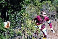
Compressed chase
For the Red and Blue runners, and perhaps also for strong Green runners, a "compressed chase" format will be used. The format is designed to generate a closely contested chase event, even with the number of competitors typical of a local event. The idea of a compressed chase is that a short preliminary course is used to seed the competitors, and then the competitors start a second course on 30-second intervals, based on their rank on the first course. So, even if the competitors spread out during the preliminary seeding course, their starts are "compressed" together for the second chase course, virtually guaranteeing competitors chance to run closely with other competitors. The final results for the combined race is determined by the order in which competitors finish the chase course; the first person crossing the finish line is the winner.
The compressed chase race has two parts; a preliminary course and a chase course. The preliminary course uses normal staggered start times and time spent on the course determines the results; the fastest time is the winner.
Then, the results from the preliminary course is used to determine the start order for the chase course. Times from the results are ignored, only the finishing order matters. That is, the competitors are started for the chase course in the order they finished the preliminary course. A 30-second starting interval is used. So, even if the 4th and 5th place finishers were separated by 5 minutes in the preliminary race, they will start only 30 seconds apart for the chase course. Thus, the name "compressed chase".
The final results for the combined race is determined by the order in which competitors finish the chase course, not by the time it takes them to complete the courses. That is, the first person crossing the finish line is the winner, regardless of the time he/she spent on the courses.
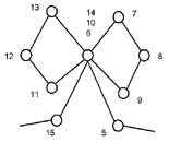
The chase will use a Butterfly Loop.
Hope you enjoy the courses!
Driving Directions
From the Peninsula, take Highway 85 south to Almaden Expressway. Head south 5 miles to the end of the road. Turn right onto Harry, and then immediately left onto McKean. The main park entrance is 5 miles south on McKean. Go past the boat ramp and turn right at the entrance marked "Calero County Park; Park Office; Equestrian Center; All Trailheads."
From the East Bay, take Highway 101 south past San Jose and exit at Bernal Road west. Immediately turn south onto Monterey Highway (bear right, then make a left turn). Go south 3.4 miles and turn right at the traffic light onto Bailey Avenue. After 2.9 miles west, Bailey ends at McKean; turn left and go south 0.7 miles to the park entrance.

