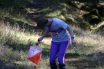
Sunol Regional Wilderness
Date: (Sun.) Oct. 27, 2019
Location: Sunol, CA
Event Director:
Course Setter: Yurii Konovalenko
Type: B; Standard seven-course event for beginners through advanced at one of our more popular parks
Related Event Information
Course Setter’s Notes
By Yurii Konovalenko
General
We’ve set up the courses to take advantage of the beautiful and hilly terrain Sunol Regional Wilderness is known for.
Be extra cautious and careful on steep terrain, and anticipate that the dried grass can be very slippery. Shoes with spikes are strongly recommended for the intermediate (Orange) and advanced (Brown, Green, Red, Blue) courses.
The competition area is open and runnable: about 80% of the map is “open landâ€.
There is poison oak on the courses. The good news is that it is late season, so the poison oak is dry with little of the oil that causes allergic reactions. Unfortunately, many of the leaves have fallen so that it can be hard to identify and avoid. We recommend washing soon after orienteering. If you are new to poison oak, read about it here, or talk with one of the regulars about their poison-oak precautions.
All the courses are designed to avoid fence crossing on reasonable route choices. To obey park rules, do not jump over, roll under, or squeeze through a fence—go around or use a gate. The Rangers are particularly sensitive about the fences, and we need to stay on good terms with them!
Remember to check the control numbers! In this open terrain, many features look the same, and you can see control flags far away, so it is easy to mix up.
Course Details
    Course    Distance    Climb   Controls   Navigation
    White      2.3 km      60 m       8      Beginner
    Yellow     2.7 km      90 m       9      Adv. Beginner
    Orange     3.8 km     278 m      12      Intermediate
    Brown      3.5 km     158 m      10      Advanced
    Green      4.3 km     285 m      13      Advanced
    Red        6.7 km     405 m      19      Advanced
    Blue       8.1 km     555 m      23      Advanced
Beginners should be aware that the distances shown are the cumulative straight-line distances between controls. Your actual distance will be somewhat longer. For a rough estimate of how far you might actually go, mentally change “km†to “mi†(e.g., for a “2.3 km†course, you might travel up to “2.3 miâ€). The climb numbers represent the amount of ascending that would be done on the “optimum route†(in the Course Setter’s opinion), without regard for any descending.
To make the courses more interesting and challenging for advanced orienteers, the Red and Blue courses contain a “butterflyâ€. Be aware that runners will punch the center control three different times during the butterfly. You can read about butterfly loops here.
The intermediate and advanced courses have water stops at controls, spaced approximately 2–3 km apart. All the controls with water are labeled on the control descriptions.
Map
The map scale is 1:10,000 for all the courses. The contour interval is 7.5 m.
The quality of the map varies. I tried to update it around the courses. However, there some unmapped cow trails, which I did not add since they tend to come and go. The contours and vegetation are generally accurate.
Special Symbols
× – Rootstock, fallen tree. This feature is used as a control location on the Yellow, Orange, and Brown courses.
o – Lone tree. This feature is used for controls on the White, Yellow, Red, and Blue courses.
 – Dense undergrowth, usually on the open land, may significantly reduce running speed.
Start
The Start is located 0.7 km from the assembly area with 90 m of climb. It takes 10–15 minutes to walk to there.
After orienteers punch the START unit and take their maps, there is a 100 m chute to where navigating begins (i.e., where the triangle on the map is located on the ground). We’ll have volunteers at the Start area to answer any questions if this is new to you.
Finish
The Finish is located at the assembly area, near registration and parking.

