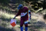
Public Event at Scout-O Championships
Briones Regional Park
Date: (Sun.) Oct. 13, 2019
Location: Lafayette, CA
Event Director: - 925.934.6567
Course Setters: Gavin Wyatt-Mair, Steve Harrison
Type: B; Open Event for non-Scouts — Regular 7-course BAOC event in conjunction with the Scout-O Championships
Event Director's and Course Setters' Notes
By Gavin Wyatt-Mair
Note: These notes are also available in this PDF file (95KB).
This is the 27th Bay Area Scout Orienteering Championships!! All scouts and non-scouts are welcome to attend, run a course, and have a generally good time! The forecast is for fine weather. It is a good area for picnics, so bring your friends and your family, and enjoy the park as well as the orienteering challenge. We will have some snacks for you to eat.
By order of the Park District: No smoking anywhere. Drive only on roads.
Courses
                                            Navigational  Physical
    Course      Distance   Climb  Controls  Difficulty    Difficulty
    White(1)     3.4 km    150 m     10     Easy          Easy
    Yellow(2)    3.4 km    160 m     11     Easy          Easy
    Orange(4)    4.0 km    270 m     13     Moderate      Moderate
    Brown        3.7 km    200 m     13     Moderate      Moderate
    Long Brown   4.5 km    305 m     11     Hard          Moderate
    Green        5.4 km    305 m     21     Hard          Hard
    Red          6.5 km    390 m     24     Hard          Tough!
    Blue         7.6 km    430 m     26     Hard          Tougher!!
Map: 1:10,000 for all except the Brown courses, 1:7500 for the Brown courses; 7.5 m contours. There are two symbols used for distinct trees: the green o represents a distinct evergreen tree, while the green × represents a distinct deciduous tree.
Start: Located about 1.4 km, with 55 m gradual climb, from the assembly area. It takes 20 to 25 minutes to walk there.
Finish: Located close to the assembly area, on the way to the Start.
White, Yellow, and Orange courses: There is a steep and possibly slippery downhill slope near the end. There is a rope to help with this descent if you need it.
Advanced courses: The courses are primarily fast and open, but still require good navigation. We will explore a less-used area of the park. Footing is good, although the ground can be hard in the open areas, and sometimes the grass is slippery. Please don’t go through out-of-bounds areas. Courses are designed with butterfly, kite, and other loops—be sure to carefully get the control order correct!
All courses:
- E-punch is used, and contactless SI-AIR Beacon Mode is enabled. Please be sure to punch the “Check†punch to turn on your SI-AIR (SIAC) finger stick, if you use one. Remember that the Finish punch turns your AIR stick off, so be careful that you don’t “accidentally†punch the Finish.
- To cross fences, you may go over, under, or through wherever you like—just remember that it is barbed wire. The course setters recommend going under!
- The star thistle is way down, and is not significant. Nevertheless, long pants are highly recommended on Yellow(2) and above, and shoes or boots with cleats or a good grip would help on Orange(4) and above.
- Poison oak on the courses is also minimal.
- There are plenty of cows on the courses. They won't bother you, but don't get too close to the calves, or mama cows will get upset.
Wildlife
We have seen deer, eagles, coyote, skunks, hawks, buzzards, orienteers, turkeys, goats, cows, salamanders, and frogs.
Miscellaneous
- The Scout-O overlaps the White(1), Yellow(2), and Orange(4) courses. Please set a good example for BAOC!
- Remember that horses have the right of way, and try not to scare them.
- Be polite to other park users please (this is a requirement for future permits).
- Bring water for yourself.
- The weather forecast calls for a high of 74°F, partly cloudy, and no chance of rain.
Driving Directions
Coordinates: N37.9271,W122.1578
A $3.00 charge for parking collected at the park entry kiosk. The east dirt parking lot, south side is reserved for horse trailers. Please do not park there.
Registration will be at the west entrance to the park, off of Bear Creek Road. To get there, take route 24 West from 680 or East from 80. Exit at Orinda, heading North on Camino Pablo. After about 2 miles, turn right onto Bear Creek Road. After about 3.5 miles, the park entrance will be on your right—it is well sign-posted. (Don’t be fooled by the parking area on the left—that’s not it, but you could park there and walk if you like.)

