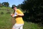
Briones Regional Park
Open Event for non-Scouts
Date: (Sun.) Oct. 8, 2017
Location: Lafayette, CA
Event Director: - 925.934.6567
Course Setters: Steve Harrison, Gavin Wyatt-Mair
Type: B; Open Event for non-Scouts — Regular 7-course BAOC event in conjunction with the Scout-O Championships
Event Director's and Course Setters’ Notes
By Gavin Wyatt-Mair
This is the 25th Bay Area Scout Orienteering Championships!! All scouts and non-scouts are welcome to attend, run a course, and have a generally good time! The forecast is for fine weather. It is a good area for picnics, so bring your friends and your family and enjoy the park.
By order of the Park District: NO SMOKING ANYWHERE. DRIVE ONLY ON ROADS.
Schedule
Registration for the regular BAOC event will be open from about 9:00 to noon.
Earliest start is at 10:00, latest start at 12:30. (Note the walk to the Start described below!)
Courses
The following courses will be available.
  Navigational  Physical
Course       Distance   Climb  Controls  Difficulty    Difficulty
White(1)      4.1 km    120 m     11     Easy          Easy
Yellow(2)     4.1 km    145 m     12     Easy          Easy
Orange(4)     5.1 km    235 m     14     Moderate      Moderate
Short Brown   3.0 km    155 m      9     Moderate      Moderate
Brown         4.4 km    210 m     12     Hard          Moderate
Green         5.8 km    280 m     17     Hard          Hard
Red           6.4 km    345 m     20     Hard          Tough!
Blue          7.1 km    435 m     22     Hard          Tough!
The Start is about 2.1 km, with 90 m gradual climb, from the parking lot—it takes 25 minutes to walk there.
The Scout-O overlaps the White(1), Yellow(2), and Orange(4) courses. Please be tolerant.
Beginners’ and intermediate courses: Please allow plenty of time to get to the Start. There will be many scouts on the courses. The ends of the courses include a steep downhill. There is a rope to assist.
Advanced courses: The courses are a mixture of forest requiring careful navigation, and open that can be taken at speed. Footing is good, the ground is hard in the open areas and leafy-slippery in the forests. The ends of the courses include a steep downhill. The Red and Blue courses will encounter a very new trail network between 195 and 197. It may or may not be accurately mapped—we did our best.
Map
The map scale is 1:10,000, with 7.5 m contours. There are two symbols used for distinct trees. The green O represents a distinct evergreen tree, while the green × represents a distinct deciduous tree.
General Comments
All the courses use E-punch. If you don't have you own, rental E-sticks are available at registration.
To cross fences, you may go over, under or through wherever you like; just remember it is barbed wire. The course vetter recommends going under fences!
The star thistle is way down, probably smothered by the long grasses after the copious rains last winter. Nevertheless, long pants are highly recommended on Yellow(2) and above, and shoes or boots with cleats or a good grip would help on Orange(4) and above. Poison oak on the courses is minimal, and typically ankle high. Red and Blue have one control where a good route choice (193–194) goes through poison oak, although the PO can be avoided with careful footwork and body-swerving. There are plenty of cows on the courses; they won't bother you, but don't get too close to the calves.
Remember that horses have the right of way, and try not to scare them.
Please be polite to other park users (this is a requirement for future permits).
Bring water. The weather forecast calls for a high of 82, sunny, and no chance of rain.
Wildlife we have seen include deer, eagles, coyote, skunks, buzzards, orienteers, lots of turkeys, goats, cows, salamanders, and frogs.
Directions
Registration will be at the West entrance to the park, off of Bear Creek Road.
To get there, take Route 24 west from I-680 or east from I-80. Exit at Orinda, heading north on Camino Pablo. After about 2 miles, turn right onto Bear Creek Road. After about 3.5 miles, the park entrance will be on your right, and is well sign-posted (don't be fooled by the parking area on the left—that's not it).
There is an entry/parking charge of approximately $4.00 per vehicle. Please carpool if possible, since there will probably be many scouts attending.
There's a map here that shows the location of the event.
Parking
Do not park in the east dirt parking lot, south side. This is for horse trailers.

