
Larger image (JPG/655KB) (http://baoc.org/gallery/albums/2015-Miscellaneous/Sunol_Scenery_2015_1200w.jpg)
Sunol Regional Wilderness
Date: (Sun.) Mar. 22, 2015
Location: Sunol, CA
Event Director: ![]() - 408.878.5073
- 408.878.5073
Course Setters: Matej Sebo, Daniel Å ebo, Lubomir Sebo
Type: B; 7-course Long event at one of our most beautiful springtime venues, with courses for all ages and abilities
Course Setters' Notes
By Matej Å ebo
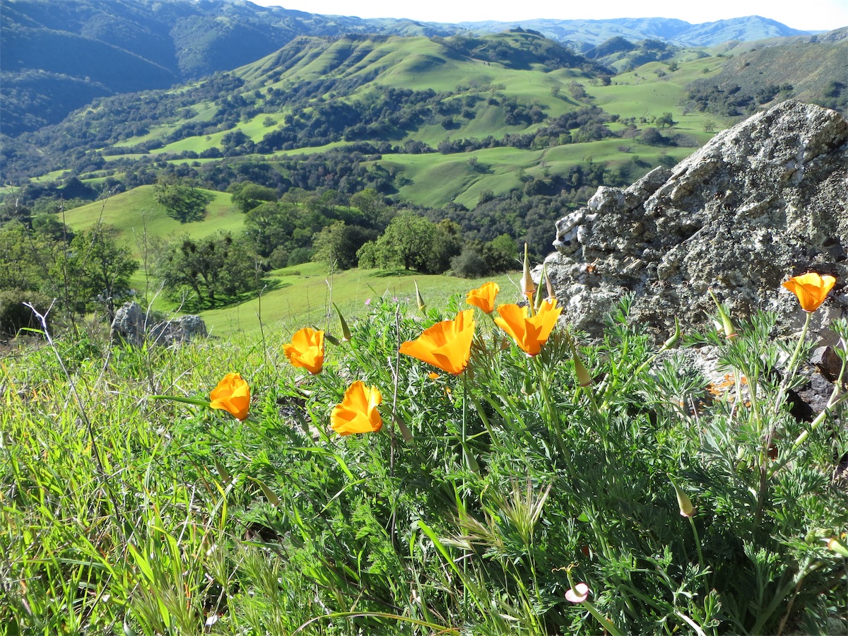
Sunol is a beautiful place at this time of the year (see the photo at the right—click on it for a larger image). The hillsides and oak trees are brilliant green, the wildflowers are spectacular, and the songbirds are in full chorus.
Important Event-Day Information
There will be three Start locations for this event:
- The Start for the White and Yellow courses is about 200 meters from the registration area (a short, 3-minute walk).
- The Start for the Orange and Brown courses is about 1.7 km (178 meters of climb) up a gradually sloping hill; getting there will take approximately 20–40 minutes. The route is almost entirely on trails and will be clearly marked with blue pin flags. Water will be provided at this Start.
- The Start for the Green, Red, and Blue courses will be 0.6 km farther (with an additional 128 meters of climb) up a steep incline. It will take about 30–60 minutes in total to reach this location (total 2.3 km, 306 m climb). (Contrary to previous information, there will be Clear and Check units at this Start.)
There will be a single common Finish location for all the courses; it will be a short walk across the river from the registration area.
Note to advanced-course runners: The Green, Red, and Blue courses are Long courses, which means that both the climb and the distance are greater than usual. These courses emphasize route choice, and will challenge competitors with several long legs between controls. Please look at the course statistics below to decide which course is best for you.
Map Comments
Originally drafted in 1991, the Sunol map is beginning to show its age, especially when it comes to vegetation. Most of the areas near controls have been thoroughly revised. Still, many thickets have expanded, and some areas of once-passable undergrowth have now become nearly impenetrable. In general, it is a good idea to completely avoid areas marked with dark green or vertical green slash on the map.
The map scale is 1:10,000 for Green, Red, and Blue, and 1:7,500 for White, Yellow, Orange, and Brown. The contour interval is 7.5 meters, which is quite a bit higher than the standard 5 meters. This means that slopes will be steeper than they might appear on the map. Please keep this in mind, especially when planning route choices.
All major trails and fences that you will encounter are on the map. Almost all major fences are made of barbed wire; gates are indicated with the black crossing-point symbol or by a gap in the fence line. These crossing points are not mandatory, but they do help in negotiating the barbed-wire fences. It is also usually possible to crawl underneath the lowest strand of barbed wire.
Large lone trees are mapped with the hollow, green, circle symbol; small lone trees and bushes are shown as green dots. Brown ×s are fallen trees; green ×s are dead trees that are still standing. (Note: These are different from previous versions of the map!) On the control description sheet, fallen trees are marked with the rootstock symbol, and dead trees are marked with the "tree, ruined" symbol. Not all fallen and dead trees are on the map.
Hazards
Poison oak is present, and most courses avoid it; however, it might be present along some route choices on the advanced courses. Areas mapped as dark green (completely avoidable) are often massive poison oak bushes, and areas mapped as undergrowth often contain poison oak as well. Long pants are recommended, as is washing with cold water and soap (or Tecnu) after the event.
There are a few steep re-entrants in the park that the Green, Red, and Blue courses will encounter. Cow paths are generally the best way to cross re-entrants. Some of the most distinct cow paths are on the map.
Participants on the Orange, Green, Red, and Blue courses will have to cross one or more barbed-wire fences; crawling underneath the lowest, loose wire is recommended.
Wildlife is generally skittish and sparse, although there are many wild turkeys in the valley at this time of year. There are a lot of cows in the park as well, but these are docile if not antagonized. Please be careful not to come between a mother cow and her calf.
Footing is mostly excellent, though there are a few areas on the advanced courses with fallen leaves that can be slippery.
Although this is technically not a hazard, we would also like to remind all runners to carefully read the map when approaching a control. Remember that not all of the controls you see will be on your course, so remember to check each control code before punching.
Final Course Statistics
                                         Water   Navigational   Physical
    Course   Distance   Climb  Controls  Stops   Difficulty     Difficulty
    White     2.6 km    110 m     11       0     Very easy      Easy
    Yellow    3.2 km    155 m     10       0     Easy           Moderate
    Orange    4.9 km    165 m     17       1     Moderate       Moderate
    Brown     4.1 km     40 m     19       1     Difficult      Easy
    Green     6.4 km    270 m     18       3     Difficult      Difficult
    Red       8.4 km    420 m     21       4     Difficult      Very difficult
    Blue      9.6 km    470 m     26       4     Difficult      Grueling
Although there will be water stops on all of the intermediate and advanced courses, carrying water is recommended, especially if you are starting later in the day.
These are Long courses, so while the navigational difficulty is the same as usual, each course is slightly longer and has slightly more climb than Classic distance.
Course distance is measured along the straight lines between controls—your actual distance will be longer. Climb is measured along the optimal route (in the course setter's opinion)—your actual climb may be less or more, depending on your route choices.