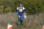
"Scout-O" Open Event
Briones Regional Park
Date: (Sun.) Oct. 11, 2015
Location: Lafayette, CA
Event Director: - 925.934.6567
Course Setters: Steve Harrison, Gavin Wyatt-Mair
Type: B; Regular 7-course BAOC event in conjunction with the Scout-O Championships
Event Director's and Course Setters’ Notes
By Gavin Wyatt-Mair
We have set a new challenge!! There are two maps on the advanced courses—a "regular" 5-color map at 1:10,000, and a brand new section of contours-only map at 1:5,000. The contours-only map is printed on the back side of your regular map. When you reach the "Map Exchange" point, simply flip your map over and continue on your course on the other map.
The contours-only map is a relatively intricate area of Briones, which should be fun and interesting for all advanced runners.
We have also added a shorter Brown course. This course does not venture into the contours-only map area, and does not have a map change.
Remember to bring water.
Note: By order of the Park District: NO SMOKING ANYWHERE. DRIVE ONLY ON ROADS.
Schedule
Registration for Regular O will be open from about 9:00.
Earliest start is at 10:00, latest start at 12:30.
The Finish will close at 2:00 PM. Everyone must report to the Finish by then, and then to the E-punch download tent (i.e., even if they have not completed their course).
Courses
                                             Navigational   Physical
   Course        Length   Climb   Controls   difficulty     difficulty
   White(1)      3.2 km   150 m      11      Easy           Easy
   Yellow(2)     3.5 km   220 m      12      Easy           Easy
   Orange(4)     4.2 km   262 m      14      Moderate       Moderate
   Short Brown   3.2 km   150 m      14      Moderate       Moderate
   Brown         4.6 km   190 m      16      Hard           Moderate
   Green         5.5 km   240 m      20      Hard           Hardish
   Red           6.4 km   270 m      24      Hard           Hard
   Blue          7.3 km   330 m      27      Hard           Hard
The Start is about 1 km, with 20 m climb, from the parking lot. It takes 15 to 20 minutes to walk there.
All the courses use E-punch.
Beginners’ and intermediate courses: Please allow plenty of time to get to the Start. The Scout-O overlaps the White(1), Yellow(2), and Orange(4) courses. There will be many scouts on the courses. Please be tolerant. The end of the courses follows a riverbed, and this may, in many cases, be the best route option.
Advanced courses: The advanced courses have a map change, except for the short version of the Brown course. Please be sure to punch the common control at the map change. The courses are a mixture of forest requiring careful navigation, and open that can be taken at speed. Footing is good. The end of the courses follows a riverbed, and this may, in many cases, be the best route option.
Maps
All the courses use Map 1: 1:10,000, 7.5 m contours. There are two symbols used for distinct trees. The green O represents a distinct evergreen tree, while the green × represents a distinct deciduous tree.
The Brown, Green, Red, and Blue courses also use Map 2: 1:5,000, 2 m contours with 1 m form lines. This map has only contours.
Hazards and Cautions
Remember that horses have the right of way, and try not to scare them. Be polite to other park users please (this is a requirement for future permits).
To cross fences, you may go over, under, or through wherever you like; just remember it is barbed wire. The star thistle is down somewhat, but long pants are highly recommended on Yellow(2) and above, and shoes or boots with cleats or a good grip would help on Orange(4) and above. Poison oak on the courses is minimal. There are plenty of cows on the courses; they won't bother you, but don't get too close to the calves. Ponds shown on the map, in many cases, are currently dry.
The weather forecast calls for 80+ temperatures, mostly sunny and no chance of rain. Remember to bring water.
Poison oak on the courses is minimal to zero. Wildlife we have seen include deer, eagles, coyote, skunks, buzzards, orienteers, ticks, turkeys, goats, cows and frogs.
Directions
Registration will be at the West entrance to the park, off of Bear Creek Road. To get there, take route 24 West from 680 or East from 80. Exit at Orinda, heading North on Camino Pablo. After about 2 miles, turn right onto Bear Creek Road. After about 3.5 miles, the park entrance will be on your right—it is well sign-posted. (Don’t be fooled by the parking area on the left—that’s not it ... but you could park there and walk if you like.) There is a $3.00 charge for parking.
Parking
Do not park in the east dirt parking lot, south side. This is for horse trailers.

