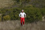
Point Pinole Regional Shoreline
Date: (Sun.) Apr. 12, 2015
Location: Richmond, CA
Event Director: - 925.862.2978
Course Setter: Steve Gregg
Type: C; Beginner and intermediate courses at a popular "fast" venue
Course Setter's Notes
By Steve Gregg
Note: These Notes have been revised since the preliminary version was posted. (April 10)
It's shaping up to be a gorgeous day at Point Pinole this Sunday. I hope the tiny bit of rain earlier in the week softened the terrain a little, so it won't be quite as hard for me to place the control stands firmly into the ground. In any case, I'm anticipating not being able to get some of the stands as solidly positioned as I would like, so please don't be too rough when punching the units, as you might end up knocking the stand completely out of the ground. Should that happen, please try as best you can to put it back!
Along with standard White and Yellow courses, "Middle" and "Long" Orange courses will be offered at Point Pinole this year. In keeping with now-standard orienteering course terminology, the "Middle" course will feature controls in areas as technical as the map allows, and with legs shorter in length than the "Long" course, which will feature as much route choice as the map allows. Additionally, for runners who want to get their money's worth, you can run the "Middle" course, exchange maps at the staging area, and then run the "Long" course immediately afterwards. The terrain at Point Pinole is flat and fast for the most part, and I'm expecting a winning time of under one hour for this "Middle+Long" combined course.
The courses and the map scale have been changed since my previous announcement. The White, Yellow, and "Middle" course maps will be printed at 1:5000 scale, not 1:7500 as was previously announced. The "Long" course map will still be printed at 1:10000 scale. Additionally, to make the "Middle" course a little more "middle-like", several controls were added, and to make the "Long" course a little more "long-like", one control was removed. So the new course stats are as follows:
    Course                 Length    Climb   Controls
    White                  3.1 km     65 m      10
    Yellow                 3.0 km     55 m      12
    "Middle" Orange        3.9 km     70 m      17
    "Long" Orange          6.2 km    100 m      13
    "Middle+Long" Orange  10.1 km    170 m      30
Additionally, one control was moved out of a pretty bad poison oak area. But don't worry, PO fans, you will still see plenty of the stuff on the "Middle" and "Long" courses. Take the usual precautions if you are particularly sensitive to PO.
There will be one common water control, which all the courses will visit. Additionally, there is a mapped water fountain between controls 9 and 10 on the "Long" course, which competitors may choose to visit as well.
Due to this winter's record-low rainfall, there is virtually no standing water in the park, so you will not have to worry about unmapped swamps, or even about getting your feet wet. However, those on the Orange courses should be aware that some of the open fields are still covered in tall grass, and between that, the uneven footing, and the fallen eucalyptus trees, I suggest you run with cleated shoes or spikes.
The goats appear to be completely out of the park now—hooray! The grass is nice and short in areas where they have grazed, but can be quite tall in areas where they have not. Unfortunately, the courses go where the goats have not grazed for the most part, so there will be substantial elephant tracks in the open areas of the map by the end of the day. So start early if you would like to run without this navigational aid, and start late otherwise!
There is a significant amount of poison oak (PO) in some of the forested regions of the park. I've added a couple of the most impressive new growths to the map, but you may well encounter large sentinels of unmapped PO between controls as well. There are several controls on the Orange courses where you will have to make detours from the most direct route to the controls if you want to completely avoid the stuff. You'll be able to easily avoid the largest clusters, but you might not even notice the individual shin- to knee-high shoots until you have already run through them. So if you are very sensitive to poison oak, be sure to take the usual precautions.
Lone trees are now mapped with the "green circle with white inside" map symbol, which I think makes them stand out a little better, especially on the 1:5000-scale maps. A solid green circle is still a thicket, which in some cases, might be hard to distinguish from a lone tree while you are running. Typically a lone tree has an obvious single brown trunk, whereas a thicket is green all the way down to ground level.
I think that's about it—see you Sunday!

