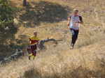
Big Basin Redwoods State Park
Date: (Sun.) Aug. 30, 2015
Location: Boulder Creek, CA
Event Director: - 831.439.9822
Course Setter: Nick Corsano
Type: B; We return to this beautiful park for point-to-point courses for beginners through advanced
Course Setter's Notes
By Nick Corsano
Do you miss the forest? Do you miss the hills? Well, there will be plenty of both for you to enjoy on Sunday at Big Basin Redwoods State Park.
The full set of seven courses is being offered. The statistics are shown below. The White and Yellow maps are printed at a scale of 1:7500; the rest are at 1:10000. There are two separate Start and Finish locations: one for White and Yellow, the other for Orange through Blue—make sure you go to the correct Start. The beginner Start is just across the bridge from the assembly area; the other Start, and both Finishes, are within five-minute walks.
   Course     Length     Climb   Controls   Technical Difficulty
   White      2.2 km      30 m      10      Easy
   Yellow     2.8 km     180 m      14      A little harder
   Orange     3.6 km     270 m      16      Moderate
   Brown      3.4 km     250 m      12      Difficult
   Green      4.3 km     390 m      19      Difficult
   Red        5.3 km     520 m      18      Difficult
   Blue       7.3 km     630 m      22      Difficult
Important! Everybody must check in at the assembly area and download their E-stick, whether or not they complete their course. That's how we know you're not lost in the woods. Everybody must be back by 2:00 PM.
Beginners should be aware that the lengths shown above are the cumulative straight-line distances between controls. Your actual distance will be somewhat longer. The climb numbers represent the amount of ascending that would be done on the "optimum route" (in the Course Setter's opinion), without regard for any descending.
A note for the Yellow course: The maps were inadvertently printed using symbolic control descriptions (aka clue sheets), rather than the textual versions standard for the beginners' courses. Textual control descriptions can be found on the back of the map and on the loose clue sheets available at Registration.
Despite the statistics, I think that the advanced courses are easier than last year's. The course lengths are mitigated by the fact that all the courses have chunks of trail running to get past areas where the steepness or the thick vegetation (or usually both) preclude effective orienteering. There are very steep off-trail climbs on Orange and above; runners on those courses are advised to wear the footgear (cleats, hiking shoes) that gives them the best traction on a slope. There is water at one control on the Orange and Brown courses, at two controls on Green and Red, and at three on Blue.
The Orange and advanced courses all come close to (and sometimes pass through) some of the park's campgrounds. Please remain on trails in those areas. I have used the vertically-striped, purple, "out of bounds" symbol to indicate areas runners should avoid so as not to disturb campers when entering or leaving a campground. Conversely, areas of open forest without the purple stripes are usable routes.
None of the courses cross the main park road (Highway 236), but the advanced courses all cross other park roads. Traffic is intermittent, so please be alert. If you are tempted to run on a road for a distance, there is usually a parallel trail that is just as effective a route, and much safer.
Along with the steep slopes, your progress will frequently be slowed by the abundant deadfall on the ground—everything from tiny twigs, to fallen branches, to huge downed redwoods—all on top of a thick layer of redwood duff. As a rule of thumb, the fastest navigation (apart from trails) is along ridge lines; spurs are usually easier to navigate than adjacent re-entrants; and contouring over any significant distance will be more unreliable than usual.
Here is an introduction to the mapping conventions related to redwood forest. Many areas feature continuous expanses of redwoods. In other places, stands of redwoods (often circular) are embedded in mixed forest. Many of these are mapped, using the vegetation-boundary symbol (black dots). Redwoods also account for three types of point feature on the map. A few exceptionally tall and wide trees have been mapped with the small, green, circle symbol (identifying distinctive trees in a forest where 50-meter trees are common is obviously subjective). There are many massive stumps remaining from the time, more than a century ago, when much of the park was logged. When a redwood tree meets its demise due to natural causes, it either is uprooted, or splits above the ground, leaving a snag. In the first case, the rootstock may soar into the air like a bizarre multi-armed sculpture. Many of the most prominent rootstocks are mapped using the brown × symbol. Both the largest stumps and snags are mapped using the green × symbol. On the clue sheets, rootstocks are indicated by the ×-inside-a-circle symbol; the stumps and snags use the combination of the distinctive-tree symbol and the "ruined" modifier.
Since the huge fallen trees present significant navigation obstacles, many have been mapped, using a thin black line oriented correctly and with length to scale. None of the fallen trees are used as control locations for this event.

