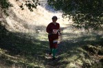
Tilden Regional Park
Date: (Sun.) Feb. 16, 2014
Location: Berkeley, CA
Event Directors: - 925.516.7622,
Course Setters: Graham Brew, Christine Brew
Type: B; Standard 7-course event. Beginner instruction & courses offered.
Course Setters' Notes
By Graham and Chris Brew
The Start and Finish for all the courses is at Lake Anza. The final gate into the Lake Anza parking area should be opened by the rangers for BAOC—in any case follow the signs to Lake Anza as far as the road goes, and park there. If you have to park in the "lower" lot, climb the steps to the Start/Finish area, which is on the large grassy area adjacent to the Lake Anza parking lot.
Courses
A full suite of seven beginner to advanced courses are on offer. Here are the final details of the courses:
                                        Navigational  Physical
   Course   Distance   Climb  Controls  Difficulty    Difficulty
   White     1.8 km     60 m     11     Easy          Easy
   Yellow    2.2 km    100 m     12     Easy          Easy
   Orange    3.7 km    210 m     16     Moderate      Moderate
   Brown     4.1 km    245 m     12     Hard          Harder
   Green     4.7 km    285 m     18     Hard          Harder
   Red       6.2 km    420 m     21     Hard          Hard
   Blue      7.0 km    490 m     24     Hard          Hard
The distances shown above are the cumulative straight-line distances between controls. The actual distance traveled on a course will be somewhat more, depending on route choices and any errors made.
The climb numbers above represent the course setters' opinions of the optimum routes, with no consideration of downhill travel.
All the courses use E-punch.
Beginners' Courses
There is an extensive network of trails in Tilden Park, and in some cases new trails have been blazed near the old ones. It's a good idea to use other features to locate yourself, not just the trails. The White and Yellow courses do not have drinking water at any of the controls.
Advanced Courses
As can be expected at Tilden, the advanced courses are fairly steep, all having between 6% and 7% climb. There are a number of water fountains near the advanced courses, and they are marked with blue circles on the map. Water has also been placed at selected controls—one on Orange, two per advanced course.
Map
The Tilden Park map is generally very accurate. Some areas of vegetation have grown up, but not enough to warrant any changes. There are a number of unmapped casual trails as we often find in highly used areas.
The map scale will be 1:5000 for the White, Yellow, and Orange courses, and 1:10,000 for the advanced courses. The contour interval is 5 meters for all the courses.
Hazards
The longer courses in Tilden generally include steep areas, with a variety of undergrowth. This year's dry spell has left many areas dusty, rocky, and occasionally loose underfoot. Grassy areas that might typically be softer this time of year are very hard underfoot. Strong shoes with rubber cleats or studs are highly recommended, especially for the advanced courses on which there will be a lot of hillside traverses.
Long-sleeved shirts, long pants, and gaiters are also strongly advised for the advanced courses, because various undergrowth will be traversed. Poison oak is present in various areas off trail—take the usual precautions if you are sensitive to it. It tends to be in the dormant non-leafy state right now—knowing how to recognize it would be useful!
The courses have been designed away from active roads to a large degree, but cars are present, so please be very careful crossing roads.
They're not a hazard, as such, but please be mindful and respectful of all other park users. On recent weekends the park has been very busy, owing, in part, to the unseasonable weather (which we hope will apply during the event).

