Huddart Park
Date: (Sun.) Nov. 17, 2013
Location: Woodside, CA
Event Directors: - 650.906.9672, - 650.867.5476, Tom Cronin - 650.368.9206
Course Setters: Matthias Kohler, Nick Corsano
Type: B; Standard seven beginner to advanced courses, plus a Long Orange course
Course Setters' Notes
By Nick Corsano & Matthias Kohler
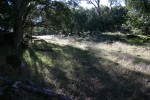
The Bay Area Orienteering Club returns to the beautiful redwood forests of Huddart Park on the eastern slope of the Santa Cruz Mountains. We will be based at the Werder Shelter. Parking, registration, the Finish, picnic tables, restrooms, and a kids' playground are in close proximity. There is a single Start for all courses, a gentle 15-minute walk from Werder.
Courses
Eight courses are being offered. These are the statistics:
Course Length Climb Controls
    White          2.2 km       75 m        9
    Yellow         2.4 km      110 m       10
    Orange         3.5 km      175 m       14
    Long Orange    5.0 km      250 m       20
    Brown          3.0 km      190 m       12
    Green          3.9 km      245 m       15
    Red            4.6 km      350 m       19
    Blue           5.8 km      425 m       24
All the maps are printed at the scale of 1:7500 (i.e., not the normal 1:10000 scale).
Huddart is a steep park, as reflected in the climb figures for the courses. The contour interval is 5 meters, and there is certainly some imprecision in contour lines (typical of redwood forest). As a result, it is often impossible to judge just how steep a hillside is from the map alone. Advice to advanced runners: wear cleats, trust your senses, know your limitations, and have a Plan B. Because of the very physical nature of the terrain, we do not recommend this as the time to move up to a longer or more advanced course.
There is water on every course. For the White, Yellow, Orange, and Long Orange courses, water is placed at a major trail junction that all four of these courses will pass. The spot is marked on the map with a cup symbol, but it's hard to read. Just remember it's by a bridge over the creek. Long Orange has a second water stop, at a control, marked on the clue sheet. Brown has a single water stop; Green, Red, and Blue have two each. All of these are at controls, and indicated on the clue sheets.
Cautions
All courses: Huddart is popular with equestrians, and it is mandatory that all runners yield the right of way to horses. If you encounter people on horseback, you must stand by the side of the trail and let them go by. If you are about to emerge from the woods onto a trail, take a quick look for horses first. There will also be hikers, picnickers, and other group events in the area. Please be considerate of them.
All courses: Be careful crossing roads within the park—there is occasional traffic.
All courses: Although Huddart has been notorious for poison oak in the past, this year the growth is moderate, but runners should still take precautions.
Red and Blue: The course brings you somewhat close to Kings Mountain Road (KMR), the winding road you drive up to reach the park. Kings Mountain Road is out of bounds. You may not stand, walk, or run alongside, on, or across KMR. The lack of a shoulder, blind curves, and road habits of both drivers and bicyclists make this unsafe. It is not a sensible route choice in any case. The road is marked with purple Xs on your map.
Brown, Green, Red, and Blue: There is a second out-of-bounds area—a deep gully that is uncrossable for a distance of about 100 meters. The forbidden section is marked with purple Xs, and course legs have been designed to go around this section.
Map Comments
Vegetation (and how it is mapped) merits some comments. Most prominent are the redwoods. There are areas, particularly in the northern and western part of the park, where there are large expanses of redwoods. These are the most runnable parts of the terrain. In other places, stands of redwoods (often circular) are embedded in mixed forest. Many of these are mapped, using the vegetation boundary symbol (black dots). Some of these stands have been used as control locations. For these controls, qualifiers such as "northern edge" refer to the stand of redwoods. Redwoods also account for three types of point feature on the map. A few exceptionally tall and wide trees have been mapped with the green circle symbol. There are innumerable huge redwood stumps, and many of the largest of these have been mapped, using the green × symbol. When used as a control location, the description "distinctive tree, ruined" is used. The brown × represents a rootstock. Only the largest or most prominent of these have been mapped, usually over 2 meters high. Remember that there are many more of all these features that have not been mapped.
The mixed forest is generally mapped as white, although much of it should probably be mapped in some shade of green. In these areas, a runner is likely to encounter fallen trees, patches of underbrush or dense growth that impede forward progress. The course setters have attempted to refine the vegetation in several areas, but all the advanced courses still have legs where runners will have to deal with this misleading white terrain.
Boulders on the hillsides tend to be fairly isolated, and some mapped ones may be as small as 0.5 meters. Creek beds are home to large numbers of boulders, and generally only the huge ones are individually mapped.

