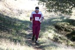
Roberts Regional Recreation Area & Joaquin Miller Park
Date: (Sun.) Jul. 10, 2011
Location: Oakland, CA
Event Director: - 510.681.6181
Course Setter: Jonas Kjall
Type: B; Beginner (White and Yellow), intermediate (Orange), and two advanced (Brown/Green and Red/Blue) courses; followed by a social potluck and navigational training activities for everyone
For the first time in three years, BAOC returns to the beautiful redwood forest in Joaquin Miller and Roberts Regional Park, just outside of Oakland. The registration and finish area will be in Roberts Regional Park, at the Bay Vista picnic area, which is ideal for families and has something for kids of all ages. We are looking forward to a fun day of activities, including a potluck BBQ and training activities.
Five courses will be offered in the morning: the regular beginner (White and Yellow) and intermediate (Orange) courses, as well as two advanced courses Brown/Green (~3.0 km) and Red/Blue (~4.5 km). The two advanced courses will be set independent of each other, so runners who want to do ~7.5 km of advanced orienteering can do both courses.
The advanced courses have a middle-distance format, which means shorter distances and an emphasis on technical navigation, where finding the controls constitutes a challenge. Changing speeds through different types of vegetation is part of the game. The mixed forest terrain is ideal for this format. (The beginner and intermediate courses are not affected much). Since the courses are shorter than normal, we will have a compressed start window. But Joaquin Miller is steep, so these advanced courses will still be a tough physical challenge.
In the afternoon, BAOC will be celebrating summer with a potluck BBQ and free training activities. BAOC will provide charcoal grill space and soft drinks. Bring something to share, and enjoy the summer! The Bay Vista picnic area is right next to a volleyball court and ball field. Visit this site (http://www.ebparks.org/parks/roberts) to read about activities and historical sites in Roberts Regional Park.
The training activities will be designed to help you build navigation skills, and will be fun for both beginners and expert orienteers.
Course Statistics
Course Length Climb Controls
   White         1.5 km      35 m        9
   Yellow        2.0 km      75 m       10
   Orange        3.0 km     160 m       10
   Brown/Green   3.1 km     180 m       13
   Red/Blue      4.4 km     270 m       18
Be sure to read the Course Setter's Notes for more information about the courses.
Schedule for the Day
    9:30-10:30  Registration for the middle-distance courses
   10:00-11:00  Starts for the middle-distance courses
   12:30        Course closure
   11:30-1:00   Potluck
   12:30-3:00   Training activities
Driving Directions
From CA Highway 13, take the Joaquin Miller Road exit. Go east "up the hill" on Joaquin Miller Road, and make a left at the first traffic light, onto Skyline Blvd. Take a right into the Roberts Recreation Area ($5 parking fee), and drive as far into the parking lot as you can. Follow the event signs to Bay Vista picnic site.
There's a map here that shows the location of the event.
Public Transit
Access is not easy on Sundays, unfortunately. The best is the AC Transit 18 bus; you can get off near the top of Park Blvd where it crosses CA Highway 13 and meets Mountain Blvd. Then you'd have quite a bit of hiking or biking to do.

