Monte Bello and Skyline Ridge Open Space Preserves
Date: Sunday, November 14, 2004
Location: Palo Alto, CA.
Event Director: - 650.697.6359
Course Setter: - 408.524.2723
Type: B; Regular Event, all seven courses, includes Club Championship.
BAOC's last B meet of 2004 will be held on the San Francisco peninsula at the neighboring Monte Bello and Skyline Ridge Open Space Preserves. This will also be our annual club championship event, with awards given for fastest finishers on each course in various classes. We have lots of awards for juniors, families, groups, and older people, so you don't have to be a superstar to win -- see below for details.
This venue is known to be hot much of the year; by scheduling in mid-November we hope to avoid the heat without getting into the rainy season. We will offer white, yellow, orange, brown, green, red, and blue courses. Orange and advanced courses will take place in the Monte Bello OSP and will have a remote start on Page Mill Road. We will provide a shuttle; participants will not be allowed to park at the remote start. These courses will use electronic punching. White and Yellow courses will take place in the Skyline OSP with a start close to parking. Parking, registration, and finish for all will take place in/near the Skyline equestrian parking lot. Starts will be offered during the usual window of 10:00 a.m. to 12:30 p.m.; courses will close at 2:00.
The parking lot is small. PLEASE CARPOOL from at the Park 'n' Ride lot on Page Mill Road at 280. See Driving Directions for details.Because of the sensitivity of the area, we must restrict the number of participants. Please let us know in advance if you plan to bring a group of 8 or more people.
Club Championship
Club championship awards will be granted to the top individual or team in each of the following classes:
Classes:

Blue -- open
Red -- open, women, veteran
Green -- open, women, veteran, veteran women
Brown -- open, women, veteran, veteran women

Orange --
  open, women, veteran, veteran women
  male junior, female junior
  open team, junior team, veteran team, family team

Yellow and White --
  age 10/under, age 11-14, age 15-18
     (individual or team, oldest member determines class)
  family team
  open, women, veteran (individual or team)


Terms:

"Veteran" = age 50+
"Junior" = age 18/under
"Family" = any team with at least one adult and at least one person 12/under.

We especially encourage teams of children to try for a prize on the white and yellow courses. Teams of children may have a shadowing adult but that adult must not help.
If you wish to be considered for an award in a class other than "open", please be sure to write your class on your punch card (white, yellow) or registration stub (all other courses). We will try to have an assistant at the registration desk to help you with this.
Awards will be distributed at 2:00.
Course Notes
The Course Setter's notes are now available.
About Monte Bello Open Space Preserve
From the park website
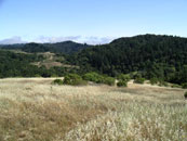
Italian for "beautiful mountain," Monte Bello Open Space Preserve is a place of rolling grasslands, dense creekside forests, and spectacular vistas. The 2,758-acre preserve is one of the District's richest in wildlife and ecosystem diversity. Hawks soar overhead, bobcats hunt, and deer browse. The preserve encompasses the upper Stevens Creek watershed from Monte Bello Ridge to Skyline Ridge. The Stevens Creek riparian corridor is considered to be one of the finest in the Santa Cruz Mountains.
Monte Bello Ridge and Black Mountain provide the scenic backdrop to the communities of Palo Alto, Los Altos, Los Altos Hills, and Cupertino. Settlers to this area named one of their towns Mountain View because they had a view of Black Mountain. From the top of Black Mountain, you can see an incredible view of Santa Clara Valley and over to the Mt. Hamilton Range. On clear days, you can see beautiful sunsets from the Black Mountain backpack camp. Or, you can watch the fog roll in from the coast. As the fog breaks like a giant wave over the peninsula, you can see why it is often referred to as "waterfog."
Stevens Creek follows the San Andreas Fault through the preserve. From the vista point at the start of the Stevens Creek Nature Trail, look down Stevens Creek Canyon to see Mt. Umunhum and Loma Prieta, the site of the 1989 earthquake. For more information about earthquakes, visit the self-guided San Andreas Fault Trail at Los Trancos Open Space Preserve on Page Mill Road, across from Monte Bello Open Space Preserve.
Dairy ranching was prevalent in this area and Monte Bello Ridge was once dotted with cattle. In the late 1800s and early 1900s, this area was the site of several ranches: the Black Mountain Ranch, the Stevens Creek Road Ranch, and the Monte Bello Ranch. The Waterwheel Creek Trail follows an old ranch road, where you can see remnants of orchards and vineyards.
Driving Directions
For the GPS'ers, finding these coordinates might be more interesting than following the textual directions:
	N  37 18.650
	W 122 10.355
From I-280 in Palo Alto, take the Page Mill Road exit and head west (uphill) just under 10 miles to the stop sign at Skyline Blvd. Turn left (cross traffic does not stop). Proceed about one mile on Skyline and turn right into the parking lot for Skyline OSP. Park in the lot to the left (the equestrian lot), after negotiating the traffic circle.
An alternate, somewhat faster route from the South Bay is to come up Highway 9 from Saratoga and after 7.5 miles, turn right onto Skyline Blvd. Go about 5-1/2 miles to the Skyline OSP and turn left into the parking lot. Be aware that road construction on Highway 9 has been underway for several months, and there may be delays. Our meet is the last posted day of construction/delays.
Carpool Information
The official carpool meeting place is the Park 'n' Ride at 280 and Page Mill Road. For most of you, this will be right on the way to the event. If you are coming from the north, it's just across Page Mill Road after stopping at the end of the exit ramp. If you are coming from the south, turn left (west) after exiting, then turn left again at the stop sign after passing under the freeway. Please, if you pass by this area on your way to the event and don't have a full vehicle, stop here and offer a ride, or wait for a ride yourself.


