Short Champs Course Setters Notes
Date: Saturday, Nov 6, 2004
Location: Morgan Territory Regional Preserve, North of Livermore, CA
Course Setter: Evan Custer
Back to Event Announcement
Terrain
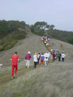
The area for the short course championships will be on some of the nicest terrain in the Bay Area. The terrain is approximately 50% open oak and bay forest, 40% grassland, and 10% fight, and is not very steep by Bay Area standards. However, the climb on the courses still will be between 5.4 and 5.9%. The white forest has good visibility and running, except on steep slopes. There are numerous rock features and some fine contour detail, which will provide interesting and challenging orienteering. There is an extensive trail network. In addition, there are many unmapped animal trails, which are more prominent this time of year, but are overgrown with grass in the spring. Most of the streams will be dry and the lakes and ponds very low or dry, unless heavy rains occur sometime between the time when these notes are written (2 weeks before the event) and the actual event.
Map
The map was produced by Zoran Krivokapic for the "O' in the Oaks" World Ranking Event in 2001, and multiple smaller corrections have been made annually since then. All maps will be printed at 1:10000 with 5-meter contours on a high-resolution Epson Stylus Printer with waterproof pigment-based (as opposed to water-soluble dye-based) ink on coated paper and sealed in plastic map cases.
There are multiple rock features, including boulders, boulder clusters, boulder fields, stony ground, and cliffs. However, they are unevenly mapped. Some areas of the map may have large 1-meter or higher boulders that are close together and mapped as boulder fields or even stony ground. Other areas may have a single isolated rock of about 0.6 meter or higher and is mapped as a single boulder. There are also many cliffs and passable rock faces. Most of these cliffs are less than two meters high but there are some exceptions.
The green "O" is generally a lone or distinct (sometimes not so distinct) tree or small copse. The green "X" is usually a standing dead tree or tall stump, although some of the trees may have fallen down since mapped. The control description will be a lone tree with the ruined modifier. The brown "X" is a rootstock, usually a fallen tree with the roots attached. However, some of the brown X's may just be fallen trees that are rotting away. Most of the medium green (walk or difficult to run) is manzanita and/or poison oak.
Format
There will be a single race, i.e., no preliminary or prologue. The courses will be designed for a 30-35 minute winning time for blue runners, and 30 minutes for the other advanced courses. The course length will be approximately that used for the IOF Medium Distance events. There will be multiple short legs, with frequent changes of direction. Detailed map reading in complex areas will require high concentration and rapid decisions. The controls tend to be clustered in the more technical areas, with longer legs traversing the less technical areas. Because of the clustering of controls, be sure and check the code number before you punch. Because the courses are short, small errors will be more noticeable in the results.
All controls will be on stands and will use SportIdent electronic punching. Insert your SI Card (or finger stick) into the unit and wait for it to beep and flash, usually within one second. If the unit fails to respond, punch your map to prove you were at the control.
   Course    Distance    Climb    No. of controls

   White      2.1 km      80 m        12
   Yellow     2.7        100          13
   Orange     2.7        155          11
   Brown      2.4        150          13
   Green      3.1        170          14
   Red        3.8        210          17
   Blue       4.4        250          22
The time limit for the courses is 2 hours.
Hazards
There is a small to moderate amount of poison oak in the park, mainly around the rocks and in some of the steeper forested reentrants. Poison oak has mainly lost its leaves at this time of year, and can be seen as a groundcover with short stems, about 1 foot high, vines, and occasional bushes. The stems and stalks still have the antigen that causes the rash, so the best policy is to identify the plant, avoid it if possible, wear long pants and long-sleeve shirts, strip and wash off with Tecnu (available at most drug stores) right after the race and again when you get back to your hotel or home, place your competition clothes, including shoes, in a plastic bag and do not touch them again until they have been washed, and use a high strength topical steroid cream (e.g., Fluocinomide, 0.05%) as soon as you feel any itching or notice any small red bumps or lines on your skin, usually about 24 to 48 hours after exposure. If you use the topical steroid cream early, you can virtually eliminate any severe rash, but if you wait until the rash has appeared, it takes much longer to get it under control.
Some of the rocks and steep hillsides are slippery. Unless more rain comes and softens up the ground, the open grasslands will have irregular footing due to cattle grazing, and it may be easy to twist your ankle. There are a lot of fox tails and other sharp grass seeds which may stick in your socks and gaiters. Rattlesnakes are common in the summer, but probably will not be out at this time of year.

Start
There are two start areas, one for the White and Yellow courses (both A-meet and recreational) and the recreational adventure race training course, and one for the Orange and advanced courses. The W&Y start is right next to the assembly area.
There is a 1.4 km walk to the start for the Orange and advanced courses. Allow at least 25 minutes to get to start. You will walk by the finish (250 meters from the parking/assembly area). Near the finish, you will have to cross the route for competitors going from the GO control to the finish line. Please look to your right, and do not interfere with runners going to the finish line. Also, near the finish, a portion of the trail will be used by competitors on the White course (and to a lesser extent) Yellow and adventure race courses. Please give these participants the right of way, and step off the narrow trail if you see them approaching you.
Start Procedure
You will be called to the Call-Up Line 2 minutes before your start. Your name, bib number, SI card, and whistle will be checked at this line. You will be asked to insert your SI card into a check station as a backup start list. At 1 minute before your start, you will advance to the Start Line. When the horn sounds for your start, you will insert your SI card into the Start EP punch (which determines your actual start time), and you will run approximately 90 meters to the remote start triangle (indicated by a control marker without a number or punch), pick up your map from the appropriate bin, and begin navigating to the first control.

Finish
The finish is 250 meters northeast and down the hill from the assembly/parking area. The electronic punching download station will be at the finish, and the results will be posted there. You may drop off a change of clothes, lunch, etc. at the finish on your walk to the start.
The finish will be shared by A-meet and recreational participants. There will be a divider in the finish chute. A-meet competitors (including White and Yellow) should stay to the left, and recreational participants will stay to the right.
Have a good time in the woods!
Evan Custer-Course Setter
Jay Hann-Assistant Course Setter
Bob Cooley, Hannu Haarma, Gary Carpenter-Vetters

